Showing posts with label halifax. Show all posts

Thursday, 9 January 2014

SNOWMOBILERS ASSOCIATION OF NOVA SCOTIA - ADVANCED MAPPING PRODUCTS

Geomapix Gateway Monthly Newsletter Follow Us

USING THE POWER OF ADVANCED LABELING IN ESRI ARCMAP

 
We have been working with this organization and have built a complex GIS system to organize mapping information so that data can be managed in near time between the development of a GIS and the deployment of a webGIS mapping application. SANS is split up into 3 management zones that contain many clubs that manage their trail information. SANS has thousands of members and it is difficult to manage information so that each member can interact and stay informed of the changes to trail information.

 
Recently, We have been working with Zone 1 & 3 representatives in updating trail and asset information. The mapping system tracks such things as trail, trail number, club, length, accuracy, collector. Also, we are mapping intersections by unique id, points of interest like stop areas, bridges, and services. For the entire network we store this information in one central location at our Geomapix Gateway hosted service from Annapolis Valley Computers. In our update process, the club reps. send us information via the SANS webGIS applications for any change or addition to trail and asset information. Our technical team make those updates via our central GIS and then post the infromation back to the webGIS for review by members. As we make the updates we have designed zone maps that are used for members and tourist coming into the province to understand the network of trails.

 
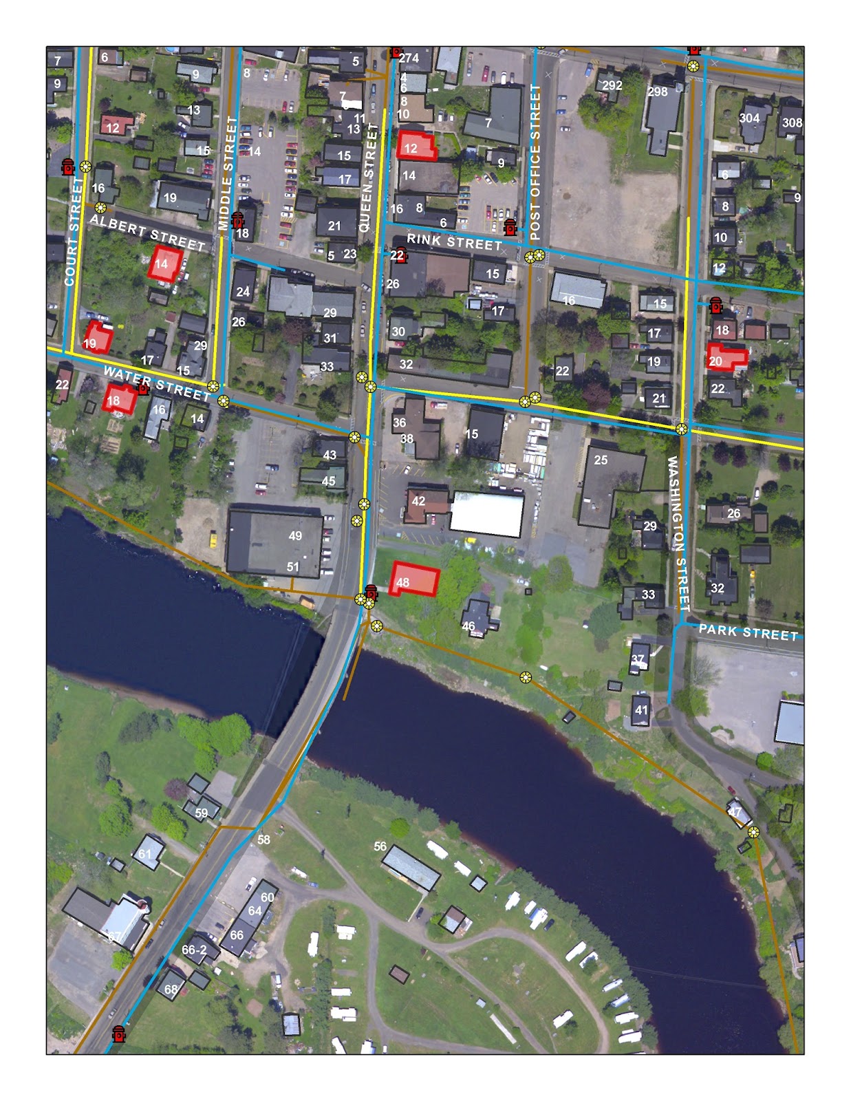
Using a combination of GIS programming and advanced map feature label technics in ESRI ArcMap map software we have built a complex map that takes a mountain of data and builds on the fly maps that are ready for production. There can be a mountain of costs associated to map layout design and label placement when producing a map product that has thousands and thousands of map labels associated to trail and topographic information.


By making advances in labeling functions we can make a map virtually anywhere within the provincial GIS we have created for SANS. The advantage being that product and design time is great reduced and the user con concentrate on making sure that the thematic data is correct and useful to the end user.


GPS & Mobile Trail Data

We have also provided SANS with GPS data and pdf reference maps that users can add to there gps or mobile device. Also, with the quick production times we can order and deliver updated maps via paper products for user who still like the look and feel of a traditional map.

Visit the SANS map center Here.


Do you like this Article? Share It Below

Cloud GIS
 
GIS Project Management
 
 
Permit Tracking Cloud Services
 
 
News, Blogs, Video
 
 
IT Services
 
 
Annapolis Valley Computers
 
Web Design
 
Nova Scotia Networking
 

Wednesday, 24 July 2013

Geomapix Gateway July Newsletter

Geomapix Gateway Monthly Newsletter
Issue
20

Follow Us

View Previous Newsletter

My Marketing Notes

Well it’s vacation time and I decided to write up a nice and light newsletter on a few things that I have been watching for the past month. I am heading on vacation this summer so, like everyone else, I am trying to get a ton of professional and personal tasks completed before our family leaves for a camping vacation to the beach. I have my hands full with a bunch of marketing ideas and campaigns for my business. One thing that I have realized in the past year is that when you have created a product like our Local Information Utility, you need to commit as much effort in marketing the product as you do creating the product. I have recognized that being and staying connected today is a lot of work whether it’s for business or personal. Information is being consumed at an alarming rate and people have a short attention span. So your message in any situation needs to be short and to the point. I am very techy in nature and in a sales and marketing scenario the techy talk does not work that well. As a business person I have a couple of great avenues to be able to meet people and chat on a professional and a personal level. I am comfortable with beginning conversations on a personal level and letting the chat take its course.


This leads to me and the person I am talking to getting comfortable and “what we do” or “what we sell” comes out naturally. So I think the goal is to be yourself at all times and try not to talk or look-like something that you are not. This leads into the development of some great soft skills which is an additional asset for any professional. One soft skill that is very important to me is to first listen to the person you are talking to.


Recently, I found a group called Sip.Chat.Connect (SCC) and it’s bringing Nova Scotia businesses together at local café’s or professional centres to chat about business. Founded by Charlie Aubie in the 2011, the Sip.Chat.Connect meetings are totally relaxing and everyone is very open to conversation. The SCC goal is to create a living and expanding network of businesses that not only meet together, but work together, to build a community of expertise for everyone to grow and learn from. They have weekly meet-ups in a variety of locations across mainland Nova Scotia and I see it spreading to other parts of the province. Note, the weekly meet ups are free to attend and are open to any business.


As Charlie puts it, “It's about shaking hands, asking questions, and making connections. We have so much to offer here, in this great province.” Charlie is so right! We have a wealth of untapped potential here in the province. The Nova Scotia business community is smart, innovative, and full of free thinkers that know what it takes to run a small business in Nova Scotia.

Please check out their website. Follow SCC


Techy Things We're Doing

GISbuzz.com has certainly created some buzz! Our Analyst and GISbuzz.com creator Phil Schnetzer shared some stats with me last week. His Google Analytics numbers show for the first month after launched there were 5586 visitors to the site and there were 16594 page views. These are great numbers for a one month launch.


Our partner, Gerry Watson, has been working with us on the development of a web based permit tracking system for small local government. We have officially named this product PermitLogix. Local government staff will never have to deal with managing “the paper trail” again. Permitlogix is fully customizable and we can consume your current permit requirements so you do not have to change the way you do things. The PermitLogix web interface will work with any major mobile OS using a standard data connection.


Also, Gerry works with businesses to develop interactive web sites such as the one he just created for the Middle Sackville Baptist Church, check it out middlesackvillebaptist.org


Speaking of Cloud, another business partner, Annapolis Valley Computers, is part of a new dynamic way for IT managers across the globe to manage thousands of corporate desktops without the infrastructure, hassle, or expense. They have partnered with Faktor11 of Ontario to offer their MokaFive desktop management solution. This solution that can run on any hardware platform. . . Mac or PC, desktop or laptop, personal- or corporate-owned. But can still be integrated into an enterprise Windows environment. Welcome to the new era!


Don't Forget, If your in the Halifax area and would like to network please check out my calendar at Meet Up Halifax.


Do you like this Article? Share It Below

Cloud GIS
 
GIS Project Management
 
 
News, Blogs, Video
 
 
IT Services
 
 
Annapolis Valley Computers
 
Web Design
 
Nova Scotia Networking
 

Wednesday, 10 July 2013

Meet Up Halifax Nova Scotia

Follow Us


View Previous Newsletter

I am visiting Halifax, Nova Scotia, every second Tuesday of the month to connect with professionals and chat about mapping, IT, web, social media marketing, and business

James Boxall, Director of the Dalhousie GISceince Centre has graciously offered a little space for me to hook up my laptop and connect with professional across Halifax. For a small firm like ours it is greatly appreciated :)

So if you work or are visiting Halifax on business I would love to chat with you. Please checkout our Meet Up Halifax webpage to check out our calendar for available times to meet. Click Here


Cloud GIS
GIS Project Management

News, Blogs, Video

IT Services


Annapolis Valley Computers
Web Design

Thursday, 23 May 2013

The Geomapix Gateway May Newsletter is Out! - Read about our project work and internship with COGS student Allen MacMillan


Issue
18

Follow us and stay up to date

Centre of Geographic Sciences: Student Final Term Project

Since 2009 our team has been working with the Centre Of Geographic Sciences (COGS) to provide graduating student a final term project and possible student internship.


Each year a COGS instructor contacts us to look at ideas for developing a work term. The goal is to create a real world project for the student so that they can get their feet wet when it comes to entering the GIS industry.

The process is completely professional and creates an opportunity for the sponsor to have a look at new GIS software processes and functions prior to implementing them across the business. The student gets a chance to build a project concept from beginning to end and build a project work plan, budgeting, and researching the proposed project. The final term project usually leads into an internship to prepare the student to enter the workforce.

Visit Landmark Geographic Solutions IncPowered By GeomapixOur 2013 student, Allen MacMillan, is a second-year cartography student with a keen eye not only for cartographic design but building a GIS and modelling for our project. Working with a local development authority we decided to look at a crop suitability model. The suitability model is based on growing hops for the brewery industry in the Annapolis Valley.

The goal was to identify the geographic data requirements and build a spatial analysis tool to identify a low, medium, and high potential of growth and put together a cartographically pleasing map product to be delivered to the Nova Scotia Agricultural Department.

By identifying data requirements we can understand what information needs to be collected or improved to build the suitability model correctly. Also by creating a Geographic Information System and analysis tool it will give the agricultural department the ability to expand their expertise in crop suitability mapping.

First off, Allen researched the best growing environment for hops; which is fast draining soils, South facing slope for sun exposure (using a TIN Model), a PH level of 5.6 or above, and excluded areas within 2 km of the shoreline. Other geographic data included identifying non forested and non wetland areas.

So Allen set out to create an Esri ArcGIS suitability model which became the heart of the entire project. Allen built the model so that values could be inputted into the model to build and output suitability areas for other crops.

The final touches are just about complete and we will be presenting the final map, GIS data, and modelling to the Nova Scotia Agricultural Department.

As a LGS Inc. intern, Allen is developing a Map Atlas generator using our Nova Scotia Geodatabase for Esri ArcMap. This will allow the production of custom maps for print and webGIS. Thank you Allen for all your hard work!

Please visit Allen’s portfolio website @ http://allenrm.com/


Like this?, Share it:


Share It @ GeomaticCanada.ca


submit to GeomaticsCanada.ca


Partner Profile: Gerry Watson of Snowbound Studios


We are always happy to identify partners that have made us successful. We're recognizing Gerry Watson of Snowbound Studios in New Minas, Nova Scotia, for his great work as our development partner.


Gerry has a keen eye for web design and has the uncanny ability to understand exactly what a client needs when it comes to web development. We have been able to work with him on a variety of GIS web applications including our flagship product, the Local Information Utility (LIU), the AGRG Community Mapping Project, and our new LIU product for a building inspection tracking system.

Gerry likes to learn, has a creative streak and wants to help solve problems. These are traits that can’t all be taught through higher education. Gerry sees the world as we do; that you can be a successful tech firm in rural Nova Scotia when you build local partnerships.

As a small firm it is difficult to be able to do all things tech. That's why LGS Inc. connects with small business expertise like Snowbound Studios because buying local and  growing the rural economy is important to us.

He sums his experience in web development quite nicely by saying;


“I am not a trained geek, it just came naturally, my education is in Geography and History, two topics that I still find deeply interesting BUT how does this make me suitable for web development? . . . I'm not sure - but I'm pretty certain it helps. I find this job requires a person, who likes to learn, has a creative streak and wants to help solve problems. These are traits you don't learn in school - well I didn't anyway.”

Gerry’s mission with Snowbound Studios is simple. He wants to work with people, talk to them, and help them realize their goals while continuing to foster his own personal and professional growth and development.

Visit Gerry’s website at http://www.snowboundstudios.ca/ or give him a ring at +19023652406

Geomapix Hosting Partner:


Tuesday, 30 April 2013

Submission to Geomatics Atlantic 2013 - A collaborative rural approach to GIS and Planning municipal shared services. The story of the Local Information Utility.


 A small group of municipalities in Southwest Nova Scotia have come together to build a collaborative approach to GIS and Planning shared services and are building a regional GIS from neighbouring rural municipalities. LGS Inc., using the latest Esri ArcServer 10.1 web technology and an innovative private cloud solution we have been able to foster municipal collaboration, an open data relationship, student projects, and have assisted staff and the public in accessing spatial information anywhere, anytime. We call the solution the Local Information Utility (LIU).


The LIU is an innovative multi-service approach to combining the latest GIS and server technology that will enable any local government to keep pace to changing GIS and IT technologies of today.

Like a water utility or electric utility, an information utility can provides real time, easy to access information services via the web. These information services are delivered from a central service location where many communities can collaborate and share in costs in managing and interacting with common spatial data, creating common services to serve the public good, all within a single IT scenario.


The Local Information Utility has always been about inspiring policymakers with the opportunities for data and analytics to transform public service for rural municipalities. The technology is present and affordable to implement a GIS system that is smart, flexible, scalable, and mobile. The LIU technology is reducing duplication of effort, paperwork, connecting departments, speeding up data retrieval, allowing for future trending, and revealing easy access GIS for front-line staff that provide information services to their citizens. The LIU is reducing data quality issues and allows an entire authority to manage their GIS, without being a GIS professional.


For our clients that have a GIS professional on staff, the LIU alleviates the pressures of delivering information in traditional formats like hard copy maps and excel reports. The GIS core can move forward with management and enhancing their GIS to deliver efficiency to the authority.


As the founder and CEO of Landmark Geographic Solutions Inc., Trevor Robar has transformed the company from a one person GIS data QC firm to a leading edge GIS enterprise and application design firm. Trevor has over 15 years of experience working with all levels of government, private industry, not for profit, and academia. A Visionary and goal-oriented senior executive with demonstrated experience in planning, developing, and implementing cutting edge spatial information solutions to address.